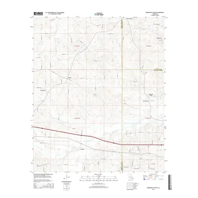
2015 Map of Downsville South
USGS Topo · Published 2015About this map
The boundary between Lincoln Parish and Union Parish bisects this northern Louisiana landscape, where several distinct rural communities were established along the local creek systems in the 2010s. The settlement of Choudrant sits to the west, while Downsville is positioned at the northern edge. Significant genealogical markers are found at Smyrna Cem and Pleasant Grove Cem, serving as historical anchors for the surrounding residential and agricultural areas.
Find a feature on this map
71 named features on this map. Tap any name to fly to it.
Don’t see what you’re looking for? This feature index may not catch every label — zoom into the map to look around manually.
Map Details
Editions of this 2015 Downsville South Map
This is the sole edition of this map. No revisions or reprints were ever made.
Other maps of this area

1950 · Ruston
USGS Topo · 1:62,500

1951 · Ruston
USGS Topo · 1:62,500

1952 · Calhoun
USGS Topo · 1:62,500

1953 · Chatham
USGS Topo · 1:62,500

1953 · Hodge
USGS Topo · 1:62,500

1955 · Shreveport
USGS Topo · 1:250,000

1956 · Shreveport
USGS Topo · 1:250,000
1982 · Calhoun
USGS Topo · 1:24,000
1982 · Cadeville
USGS Topo · 1:24,000
1982 · Point
USGS Topo · 1:24,000