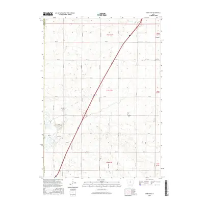
2015 Map of Dows East
USGS Topo · Published 2015About this map
Iowa River valley and the adjacent prairie lands of Wright and Franklin Counties are documented in this 2015 topographic survey. The settlement of Dows sits on the western edge of the quadrangle, where the river winds through the landscape. To the northeast, the community of Coulter anchors the agricultural grid, which is strictly defined by an extensive network of range and section line roads such as Wright Ave and 140th St. Local history and genealogy are well-represented by several rural burial grounds, including Saint Peter's Lutheran Cem, Mount Hope Cem, and Olson Cem. The drainage of the land is visible through small tributaries like Maynes Cr, illustrating how the natural hydrology interacts with the established township boundaries of T92N R22W and T91N R22W.
Find a feature on this map
42 named features on this map. Tap any name to fly to it.
Don’t see what you’re looking for? This feature index may not catch every label — zoom into the map to look around manually.
Map Details
Editions of this 2015 Dows East Map
This is the sole edition of this map. No revisions or reprints were ever made.
Other maps of this area

1954 · Waterloo
USGS Topo · 1:250,000

1955 · Waterloo
USGS Topo · 1:250,000

1972 · Alexander
USGS Topo · 1:24,000

1972 · Belmond
USGS Topo · 1:24,000

1972 · Latimer
USGS Topo · 1:24,000

1978 · Sheldon Creek
USGS Topo · 1:24,000

1978 · Dows West
USGS Topo · 1:24,000

1979 · Dows East
USGS Topo · 1:24,000

1979 · Coulter
USGS Topo · 1:24,000

1979 · Iowa Falls West
USGS Topo · 1:24,000