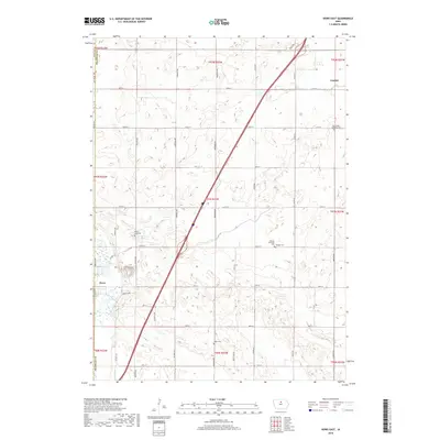
2018 Map of Dows East
USGS Topo · Published 2018About this map
Dows and Coulter anchor this agricultural landscape along the county line between Wright and Franklin counties. The Iowa River meanders through the southwestern corner, while Maynes Creek cuts across the northern section near Coulter. This 2018 survey reveals a well-established rural grid defined by roads like Wright Avenue and Eagle Avenue, supporting a network of long-standing community centers. Local heritage is preserved in several rural burial grounds, including Saint Peter's Lutheran Cemetery and Mount Hope Cemetery. The presence of the Morgan Township Hall further emphasizes the administrative and social structure of this Midwestern farming region, where the terrain is punctuated by small water bodies and the intersections of county highways like County Highway S13.
Find a feature on this map
44 named features on this map. Tap any name to fly to it.
Don’t see what you’re looking for? This feature index may not catch every label — zoom into the map to look around manually.
Map Details
Editions of this 2018 Dows East Map
This is the sole edition of this map. No revisions or reprints were ever made.
Other maps of this area

1954 · Waterloo
USGS Topo · 1:250,000

1955 · Waterloo
USGS Topo · 1:250,000

1972 · Alexander
USGS Topo · 1:24,000

1972 · Belmond
USGS Topo · 1:24,000

1972 · Latimer
USGS Topo · 1:24,000

1978 · Sheldon Creek
USGS Topo · 1:24,000

1978 · Dows West
USGS Topo · 1:24,000

1979 · Dows East
USGS Topo · 1:24,000

1979 · Coulter
USGS Topo · 1:24,000

1979 · Iowa Falls West
USGS Topo · 1:24,000