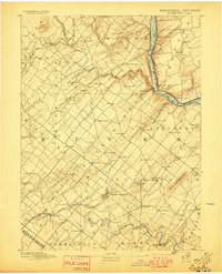
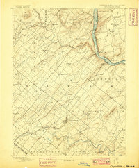
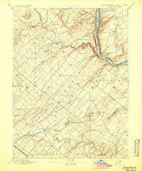
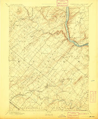
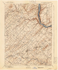
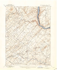
1891 Map of Doylestown
USGS Topo · Published 1897About this map
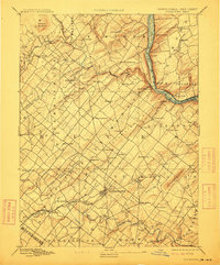
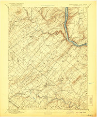
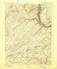
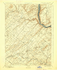
Doylestown serves as the focal point of this late 19th-century survey, positioned at the terminus of the Doylestown Branch and along the Penna Railroad. The map reveals a densely settled rural landscape of Bucks County, where crossroads communities like Plumsteadville, Gardenville, and Kellers Church were connected by a web of early roads and small streams. To the east, the Delaware River forms a sharp boundary, flanked by the riverfront villages of Lumberville and Point Pleasant. The terrain is punctuated by significant elevations such as Haycock Mountain in the north and Buckingham Mountain to the southeast. Local industry is anchored by milling, notably at Milltown, while the distribution of schools and small settlements like Mechanicsville and Blooming Glen illustrates the social and economic organization of the county before the suburban expansion of the following century.
Find a feature on this map
92 named features on this map. Tap any name to fly to it.
Don’t see what you’re looking for? This feature index may not catch every label — zoom into the map to look around manually.
Map Details
Editions of this 1891 Doylestown Map
11 editions found

1891 edition
16.5 x 19.9 inches
1897 edition
16.5 x 20.4 inches
1899 edition
16.5 x 20 inches
1905 edition
16.5 x 20 inches
1908 edition
16.5 x 20 inches
1912 edition
16.5 x 19.9 inches
1921 edition
16.5 x 20 inches
1930 edition
16.5 x 20 inches
1934 edition
16.5 x 20 inches
1941 edition
16.5 x 19.9 inches
1943 edition
17.1 x 20.9 inches
Other maps of this area

1888 · Quakertown
USGS Topo · 1:62,500

1890 · Easton
USGS Topo · 1:62,500

1890 · High Bridge
USGS Topo · 1:62,500

1890 · Lambertville
USGS Topo · 1:62,500

1890 · Doylestown
USGS Topo · 1:62,500

1890 · Burlington
USGS Topo · 1:62,500

1890 · Quakertown
USGS Topo · 1:62,500

1891 · Easton
USGS Topo · 1:62,500

1891 · Lambertville
USGS Topo · 1:62,500
1891 · Doylestown
USGS Topo · 1:62,500
Featured Places
- Warrington Township, PA
- Buckingham Township, PA
- Hilltown Township, PA
- Solebury Township, PA
- Doylestown, PA