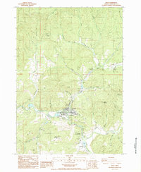
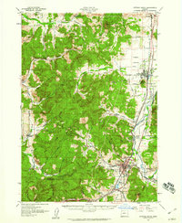
1987 Map of Drain
USGS Topo · Published 1987About this map
The town of Drain serves as the central hub for this Douglas County region, situated at the confluence of several vital waterways including Elk Creek, Yoncalla Creek, and Drain Creek. The landscape is defined by the surrounding peaks of Mount Yoncalla and Green Mountain, with a series of passes and gaps like Windy Gap and Pass facilitating movement through the steep terrain. Local history and recreation are centered around the Anna Drain Douglas County Park and the Jesse Applegate Historical Marker, which notes the area's significance in Oregon trail-era pioneering. To the north, the small settlements of Leona and Krewson follow the corridor of Krewson Creek. This late-1980s data records the established rural infrastructure of the period, from the Boswell Mineral Springs in the south to the scattered logging or resource operations indicated by a Quarry and numerous forest service roads.
Find a feature on this map
38 named features on this map. Tap any name to fly to it.
Don’t see what you’re looking for? This feature index may not catch every label — zoom into the map to look around manually.
Map Details
Editions of this 1987 Drain Map
This is the sole edition of this map. No revisions or reprints were ever made.
Other maps of this area

1921 · Cottage Grove
USGS Topo · 1:62,500
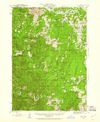
1942 · Crow
USGS Topo · 1:62,500

1945 · Crow
USGS Topo · 1:62,500
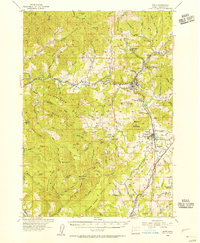
1954 · Drain
USGS Topo · 1:62,500
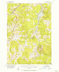
1954 · Anlauf
USGS Topo · 1:62,500
1957 · Cottage Grove
USGS Topo · 1:62,500

1958 · Roseburg
USGS Topo · 1:250,000

1959 · Roseburg
USGS Topo · 1:250,000

1979 · Cottage Grove
USGS Topo · 1:100,000
1984 · Beaver Creek
USGS Topo · 1:24,000