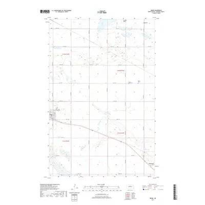
2017 Map of Drake
USGS Topo · Published 2017About this map
Drake serves as a central hub in this McHenry County landscape, defined by its position along the Soo Line RR. The town's local history is anchored by several sites of remembrance, including Drake Cem and Trinity Lutheran Cem located on its western edge. To the east, the rail line connects through the prairie toward Anamoose, while the smaller settlement of Funston sits to the north near the edge of Antelope Valley. The terrain is characteristic of the North Dakota pothole region, dotted with numerous small wetlands and the larger Flat Lake. Genealogists will find particular value in the dispersed rural cemeteries like Zion Cem, Saint Martins Cem, and the Sons of Herman Cem, which provide specific evidence of the community's early social and religious clusters away from the primary townsites.
Find a feature on this map
24 named features on this map. Tap any name to fly to it.
Don’t see what you’re looking for? This feature index may not catch every label — zoom into the map to look around manually.
Map Details
Editions of this 2017 Drake Map
This is the sole edition of this map. No revisions or reprints were ever made.
Other maps of this area

1930 · Drake
USGS Topo · 1:62,500

1940 · Aylmer
USGS Topo · 1:62,500

1951 · Anamoose SW
USGS Topo · 1:24,000

1954 · Minot
USGS Topo · 1:250,000

1954 · McClusky
USGS Topo · 1:250,000

1957 · Rangeley SE
USGS Topo · 1:24,000

1957 · Rangeley
USGS Topo · 1:24,000

1958 · McClusky
USGS Topo · 1:250,000

1958 · Minot
USGS Topo · 1:250,000
1958 · Anamoose
USGS Topo · 1:24,000