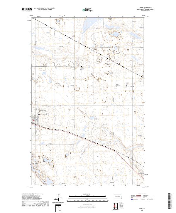
2024 Map of Drake
USGS Topo · Published 2024About this map
Drake serves as the primary hub in this portion of McHenry County, where a concentrated network of neighborhood streets like Main St and Cedar St meet several significant local burial grounds. The community's spiritual and genealogical history is well-preserved through sites such as Saint Margaret Mary Catholic Cem, Trinity Lutheran Cem, and the nearby Drake Cem. Beyond the residential center, the landscape opens into the expansive Antelope Valley, defined by numerous wetlands and the protected grounds of the McHenry County Waterfowl Production Area. To the north, the small siding of Funston and the waters of Flat Lake mark the transition toward more open prairie. This survey also documents outlying community markers like the Trinity Lutheran Norfolk Cem and Sons of Herman Cem, which provide clues to the early settlement patterns of the region's diverse immigrant groups.
Find a feature on this map
34 named features on this map. Tap any name to fly to it.
Don’t see what you’re looking for? This feature index may not catch every label — zoom into the map to look around manually.
Map Details
Editions of this 2024 Drake Map
This is the sole edition of this map. No revisions or reprints were ever made.
Other maps of this area

1930 · Drake
USGS Topo · 1:62,500

1940 · Aylmer
USGS Topo · 1:62,500

1951 · Anamoose SW
USGS Topo · 1:24,000

1954 · Minot
USGS Topo · 1:250,000

1954 · McClusky
USGS Topo · 1:250,000

1957 · Rangeley SE
USGS Topo · 1:24,000

1957 · Rangeley
USGS Topo · 1:24,000

1958 · McClusky
USGS Topo · 1:250,000

1958 · Minot
USGS Topo · 1:250,000
1958 · Anamoose
USGS Topo · 1:24,000