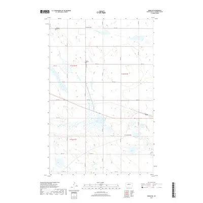
2017 Map of Drake NW
USGS Topo · Published 2017About this map
Antelope Valley and the surrounding prairie of McHenry County define this landscape, where the meandering course of the Wintering River flows southward toward the community of Drake. The map captures a high-plateau region characterized by numerous small potholes and wetlands, including Bentley Lake and Alkali Lake. Settlement patterns follow a rigid section-line grid of rural routes such as 40th St NE and 34th St NE, which connect isolated farmsteads across the undulating terrain. A significant point for local historians is the United Methodist Cem, located near the center of the survey. The topography is further distinguished by Montgomery Hill in the northwest, providing a vantage point over the expansive northern plains. This record illustrates the enduring agricultural and natural character of the region in the early 21st century.
Find a feature on this map
20 named features on this map. Tap any name to fly to it.
Don’t see what you’re looking for? This feature index may not catch every label — zoom into the map to look around manually.
Map Details
Editions of this 2017 Drake NW Map
This is the sole edition of this map. No revisions or reprints were ever made.
Other maps of this area

1929 · Balfour
USGS Topo · 1:62,500

1930 · Drake
USGS Topo · 1:62,500

1954 · Minot
USGS Topo · 1:250,000

1954 · McClusky
USGS Topo · 1:250,000

1957 · Karlsruhe
USGS Topo · 1:24,000

1957 · Rangeley SE
USGS Topo · 1:24,000

1957 · Rangeley
USGS Topo · 1:24,000

1958 · McClusky
USGS Topo · 1:250,000

1958 · Minot
USGS Topo · 1:250,000

1958 · Drake
USGS Topo · 1:62,500