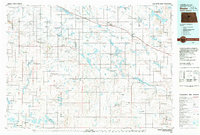
1979 Map of Drake
USGS Topo · Published 1980About this map
Balfour and Drake serve as key nodes along the Burlington Northern rail line, which cuts across this central North Dakota landscape. The late 1970s environment is characterized by an extensive network of prairie potholes and large water bodies, such as Sheyenne Lake and Krueger Lake, many of which are protected within the National Waterfowl Production Area. The southern portion of the map highlights the significant engineering of the McClusky Canal as it navigates the terrain near the Prophets Mountains. Smaller, isolated settlements like Kief, Anamoose, and the small community of Lincoln Valley represent the rural social fabric of the era. Genealogists and local historians can find specific points of interest including the Willoughby Landing Strip and various Gravel Pits that supported the local infrastructure of McHenry and Sheridan counties.
Find a feature on this map
86 named features on this map. Tap any name to fly to it.
Don’t see what you’re looking for? This feature index may not catch every label — zoom into the map to look around manually.
Map Details
Editions of this 1979 Drake Map
This is the sole edition of this map. No revisions or reprints were ever made.
Other maps of this area

1929 · Sawyer
USGS Topo · 1:62,500

1929 · Coleharbor
USGS Topo · 1:62,500

1929 · Benedict
USGS Topo · 1:62,500

1929 · Kongsberg
USGS Topo · 1:62,500

1929 · Balfour
USGS Topo · 1:62,500

1930 · Drake
USGS Topo · 1:62,500

1940 · Aylmer
USGS Topo · 1:62,500

1941 · Selz
USGS Topo · 1:62,500

1945 · Manfred
USGS Topo · 1:62,500

1945 · Pelican Lake
USGS Topo · 1:62,500