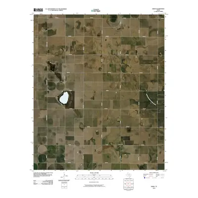
2010 Map of Draw
USGS Topo · Published 2010About this map
The small community of Draw anchors this section of Lynn County, situated amidst a grid-like network of farm-to-market roads and county lines. This landscape is defined by the agricultural layout of the High Plains, where long stretches of road like Fm 1054 and Fm 213 connect isolated farmsteads and rural dwellings. The southern reaches of the Double Mountain Fork Brazos River cut through the eastern portion of the quadrangle, providing a rare natural drainage feature in an otherwise strictly surveyed landscape. This 2010 survey reflects the enduring rural character of the region, where the spatial organization is dictated by ranching and farming divisions, evidenced by the prevalence of ranch roads such as Ranch Rd 2956 and numerous numbered county routes.
Find a feature on this map
21 named features on this map. Tap any name to fly to it.
Don’t see what you’re looking for? This feature index may not catch every label — zoom into the map to look around manually.
Map Details
Editions of this 2010 Draw Map
This is the sole edition of this map. No revisions or reprints were ever made.
Other maps of this area

1954 · Lubbock
USGS Topo · 1:250,000

1954 · Big Spring
USGS Topo · 1:250,000

1958 · Big Spring
USGS Topo · 1:250,000

1969 · Skeen Lake
USGS Topo · 1:24,000

1969 · O'Donnell
USGS Topo · 1:24,000

1969 · Tahoka
USGS Topo · 1:24,000

1969 · Indian Canyon NE
USGS Topo · 1:24,000

1969 · Grassland SE
USGS Topo · 1:24,000

1970 · New Lynn
USGS Topo · 1:24,000
1970 · Draw
USGS Topo · 1:24,000