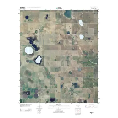
2012 Map of Draw
USGS Topo · Published 2012About this map
Draw serves as the quiet center of this high plains agricultural landscape in West Texas. The region is defined by a strict geometric grid of section roads, including Co Rd BB and Co Rd 341, which crisscross the flat terrain of the South Plains. In the eastern portion of the map, the headwaters of the Double Mountain Fork Brazos River begin to carve a subtle path across the land, offering a rare break from the uniform pattern of fields and farm-to-market roads. This 2012 survey illustrates the modern layout of Lynn County’s rural infrastructure, where routes like Fm-1054 and Fm-213 connect scattered farmsteads and ranching outposts. Local history researchers can use this detailed grid to pinpoint family homesteads and the specific intersections that have anchored this farming community for generations.
Find a feature on this map
23 named features on this map. Tap any name to fly to it.
Don’t see what you’re looking for? This feature index may not catch every label — zoom into the map to look around manually.
Map Details
Editions of this 2012 Draw Map
This is the sole edition of this map. No revisions or reprints were ever made.
Other maps of this area

1954 · Lubbock
USGS Topo · 1:250,000

1954 · Big Spring
USGS Topo · 1:250,000

1958 · Big Spring
USGS Topo · 1:250,000

1969 · Skeen Lake
USGS Topo · 1:24,000

1969 · O'Donnell
USGS Topo · 1:24,000

1969 · Tahoka
USGS Topo · 1:24,000

1969 · Indian Canyon NE
USGS Topo · 1:24,000

1969 · Grassland SE
USGS Topo · 1:24,000

1970 · New Lynn
USGS Topo · 1:24,000
1970 · Draw
USGS Topo · 1:24,000