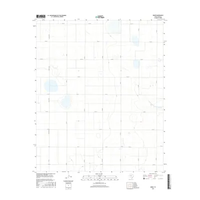
2016 Map of Draw
USGS Topo · Published 2016About this map
The settlement of Draw anchors this section of the High Plains, serving as a hub for a vast network of section-line roads and farm-to-market routes. The terrain is characterized by a series of ephemeral basins and depressions typical of the Llano Estacado, which define the local drainage patterns. In the eastern portion of the map, the Double Mountain Fork Brazos River cuts through the landscape, providing a distinct geographic break from the surrounding agricultural grid. This 2016 survey illustrates the persistent importance of the rural road system, including FM 1054 and FM 213, in connecting this remote ranching and farming community. The grid is further defined by numbered county roads such as Co RD 26 and Co RD 34, which trace the precise surveying of the Texas panhandle region.
Find a feature on this map
21 named features on this map. Tap any name to fly to it.
Don’t see what you’re looking for? This feature index may not catch every label — zoom into the map to look around manually.
Map Details
Editions of this 2016 Draw Map
This is the sole edition of this map. No revisions or reprints were ever made.
Other maps of this area

1954 · Lubbock
USGS Topo · 1:250,000

1954 · Big Spring
USGS Topo · 1:250,000

1958 · Big Spring
USGS Topo · 1:250,000

1969 · Skeen Lake
USGS Topo · 1:24,000

1969 · O'Donnell
USGS Topo · 1:24,000

1969 · Tahoka
USGS Topo · 1:24,000

1969 · Indian Canyon NE
USGS Topo · 1:24,000

1969 · Grassland SE
USGS Topo · 1:24,000

1970 · New Lynn
USGS Topo · 1:24,000
1970 · Draw
USGS Topo · 1:24,000