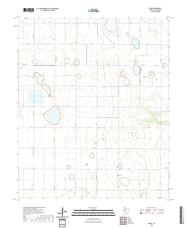
2022 Map of Draw
USGS Topo · Published 2022About this map
Draw Cem sits in the southeastern quadrant of this agricultural landscape in Lynn County, serving as a primary landmark for local genealogy and history. The terrain is defined by the ephemeral path of the Double Mountain Fork Brazos River, which cuts through the eastern portion of the survey. This 2022 U.S. Geological Survey map illustrates a persistent grid of farm-to-market roads and section lines, including FM 1054 and FM 1313, that organize the High Plains territory. The map's hydrography is characterized by numerous seasonal depressions and playa lakes common to this region of Texas, which are interspersed between the straight-line corridors of roads like Ranch Rd 2956 and FM 3332.
Find a feature on this map
21 named features on this map. Tap any name to fly to it.
Don’t see what you’re looking for? This feature index may not catch every label — zoom into the map to look around manually.
Map Details
Editions of this 2022 Draw Map
This is the sole edition of this map. No revisions or reprints were ever made.
Other maps of this area

1954 · Lubbock
USGS Topo · 1:250,000

1954 · Big Spring
USGS Topo · 1:250,000

1958 · Big Spring
USGS Topo · 1:250,000

1969 · Skeen Lake
USGS Topo · 1:24,000

1969 · O'Donnell
USGS Topo · 1:24,000

1969 · Tahoka
USGS Topo · 1:24,000

1969 · Indian Canyon NE
USGS Topo · 1:24,000

1969 · Grassland SE
USGS Topo · 1:24,000

1970 · New Lynn
USGS Topo · 1:24,000
1970 · Draw
USGS Topo · 1:24,000