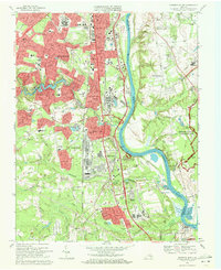
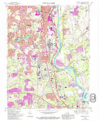
1969 Map of Drewrys Bluff
USGS Topo · Published 1971About this map
The James River carves a winding path through this industrial and military landscape south of Richmond, revealing a dense network of mid-century infrastructure and preserved history. The presence of the U. S. Dept. of Defense Supply Center and the McGuire Veterans Hospital highlights the area's strategic role during the late 1960s. Along the river's western bank, the Richmond National Battlefield Park preserves significant Civil War sites like Fort Darling at Drewrys Bluff, while the eastern side near Chaffin Bluff contains numerous fortifications including Fort Alexander and Fort Hoke.
Find a feature on this map
81 named features on this map. Tap any name to fly to it.
Don’t see what you’re looking for? This feature index may not catch every label — zoom into the map to look around manually.
Map Details
Editions of this 1969 Drewrys Bluff Map
5 editions found
Other maps of this area

1890 · Goochland
USGS Topo · 1:125,000

1892 · Goochland
USGS Topo · 1:125,000

1894 · Bermuda Hundred
USGS Topo · 1:62,500

1894 · Richmond
USGS Topo · 1:62,500

1895 · Richmond
USGS Topo · 1:62,500

1897 · Amelia
USGS Topo · 1:125,000

1934 · Seven Pines
USGS Topo · 1:24,000

1934 · Richmond
USGS Topo · 1:24,000

1936 · Richmond West
USGS Topo · 1:24,000

1938 · Dutch Gap
USGS Topo · 1:24,000