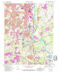
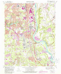
1969 Map of Drewrys Bluff
USGS Topo · Published 1994About this map
The James River meanders through this landscape, dividing the urbanized reach of Richmond and Bensley Village from the densely forested slopes and historical earthworks of the Richmond National Battlefield Park. This 1969 survey captures the intense transition of the area south of the city, where massive industrial and military footprints like the U.S. Dept. of Defense Supply Center and the McGuire Veterans Hospital sit adjacent to residential growth.
Find a feature on this map
76 named features on this map. Tap any name to fly to it.
Don’t see what you’re looking for? This feature index may not catch every label — zoom into the map to look around manually.
Map Details
Editions of this 1969 Drewrys Bluff Map
5 editions found
Other maps of this area

1890 · Goochland
USGS Topo · 1:125,000

1892 · Goochland
USGS Topo · 1:125,000

1894 · Bermuda Hundred
USGS Topo · 1:62,500

1894 · Richmond
USGS Topo · 1:62,500

1895 · Richmond
USGS Topo · 1:62,500

1897 · Amelia
USGS Topo · 1:125,000

1934 · Seven Pines
USGS Topo · 1:24,000

1934 · Richmond
USGS Topo · 1:24,000

1936 · Richmond West
USGS Topo · 1:24,000

1938 · Dutch Gap
USGS Topo · 1:24,000