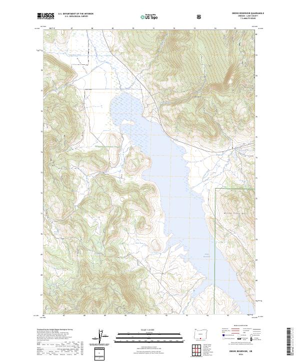
2024 Map of Drews Reservoir
USGS Topo · Published 2024About this map
Drews Reservoir dominates the drainage of this portion of south-central Oregon, where the high desert terrain meets the eastern edge of the Fremont National Forest. The reservoir is fed by a complex network of seasonal and perennial streams, including Stevenson Creek, Drews Creek, and Chandler Creek, which flow through Drews Valley before reaching the impoundment. The landscape is defined by significant elevation changes, rising from the valley floor toward the Willow Creek Hills and the prominent La Sere Point. Named water sources like Kerman Spring, Salt Spring, and Dip Spring suggest the importance of reliable water in this arid environment. The map details the transition from the forested mountain slopes in the west to the more open, creek-carved flats of the eastern range.
Find a feature on this map
24 named features on this map. Tap any name to fly to it.
Don’t see what you’re looking for? This feature index may not catch every label — zoom into the map to look around manually.
Map Details
Editions of this 2024 Drews Reservoir Map
This is the sole edition of this map. No revisions or reprints were ever made.
Other maps of this area

1955 · Klamath Falls
USGS Topo · 1:250,000

1958 · Klamath Falls
USGS Topo · 1:250,000

1960 · Strawberry Butte
USGS Topo · 1:62,500

1960 · Fishhole Mtn
USGS Topo · 1:62,500

1964 · Drews Reservoir
USGS Topo · 1:24,000

1964 · Cox Flat
USGS Topo · 1:24,000
1964 · Dog Lake
USGS Topo · 1:24,000

1964 · Cougar Peak
USGS Topo · 1:24,000
1964 · Fitzwater Point
USGS Topo · 1:24,000

1964 · Drews Gap
USGS Topo · 1:24,000