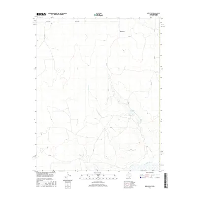
2016 Map of Dreyfoos
USGS Topo · Published 2016About this map
The Canadian River cuts across the southeastern corner of this High Plains landscape, where the ephemeral drainages of Oasis Cr and Dry Oasis Cr converge. These seasonal watercourses carve through the terrain, leading toward a cluster of small basins including Goettsche Lake, Club Lake, and Oasis Lake. The settlement of Dreyfoos sits in the northern reaches, served by a network of rural routes such as Ranch Rd 1453 and Ranch Rd 2758. The map reveals a ranching-centered geography defined by extensive section roads and the winding path of Spring Cr as it makes its way toward the primary river valley. This 2016 survey documents the modern drainage patterns and transportation grid that sustain the isolated agricultural communities in the Texas Panhandle.
Find a feature on this map
17 named features on this map. Tap any name to fly to it.
Don’t see what you’re looking for? This feature index may not catch every label — zoom into the map to look around manually.
Map Details
Editions of this 2016 Dreyfoos Map
This is the sole edition of this map. No revisions or reprints were ever made.
Other maps of this area

1954 · Perryton
USGS Topo · 1:250,000

1954 · Amarillo
USGS Topo · 1:250,000

1955 · Clinton
USGS Topo · 1:250,000

1955 · Woodward
USGS Topo · 1:250,000

1957 · Clinton
USGS Topo · 1:250,000

1958 · Perryton
USGS Topo · 1:250,000

1958 · Woodward
USGS Topo · 1:250,000

1958 · Amarillo
USGS Topo · 1:250,000

1966 · Antelope Hills
USGS Topo · 1:24,000

1966 · Durham
USGS Topo · 1:24,000