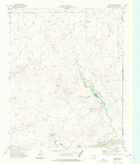
1972 Map of Dreyfoos
USGS Topo · Published 1974About this map
Oasis Creek and its tributary Dry Oasis Creek carve through this portion of the Texas Panhandle, creating a landscape defined by seasonal water flow and energy infrastructure. The tiny settlement of Dreyfoos is anchored by a Pumping Sta and a Water Tank, serving as a localized node for the numerous oil wells and complex network of pipelines that crisscross the terrain. Near the confluence of the creek and the wide Canadian River in the south, features like Goettsche Lake and Oasis Lake offer rare permanent water points amidst the high plains.
Find a feature on this map
19 named features on this map. Tap any name to fly to it.
Don’t see what you’re looking for? This feature index may not catch every label — zoom into the map to look around manually.
Map Details
Editions of this 1972 Dreyfoos Map
This is the sole edition of this map. No revisions or reprints were ever made.
Other maps of this area

1954 · Perryton
USGS Topo · 1:250,000

1954 · Amarillo
USGS Topo · 1:250,000

1955 · Clinton
USGS Topo · 1:250,000

1955 · Woodward
USGS Topo · 1:250,000

1957 · Clinton
USGS Topo · 1:250,000

1958 · Perryton
USGS Topo · 1:250,000

1958 · Woodward
USGS Topo · 1:250,000

1958 · Amarillo
USGS Topo · 1:250,000

1966 · Antelope Hills
USGS Topo · 1:24,000

1966 · Durham
USGS Topo · 1:24,000