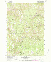
1964 Map of Drumhill Ridge
USGS Topo · Published 1986About this map
Umatilla National Forest and Wallowa-Whitman National Forest converge on this high-country landscape, where the ridge systems of the Blue Mountains define the human and natural geography. The 1964 field data reveals a working forest infrastructure centered around sites like the Summit Guard Station and established forest camps such as Camp One and Camp Three. The terrain is characterized by a dense network of water sources, including the historically named Sacajawea Spring and Tie Camp Spring, which supported the early logging and grazing operations of Union and Umatilla counties.
Find a feature on this map
70 named features on this map. Tap any name to fly to it.
Don’t see what you’re looking for? This feature index may not catch every label — zoom into the map to look around manually.
Map Details
Editions of this 1964 Drumhill Ridge Map
2 editions found
Other maps of this area

1953 · Pendleton
USGS Topo · 1:250,000

1956 · Pendleton
USGS Topo · 1:250,000

1963 · La Grande SE
USGS Topo · 1:24,000

1963 · Sanderson Spring
USGS Topo · 1:24,000

1963 · Hilgard
USGS Topo · 1:24,000

1963 · Summerville
USGS Topo · 1:24,000

1964 · Duncan
USGS Topo · 1:24,000

1964 · Thimbleberry Mtn
USGS Topo · 1:24,000

1964 · Huron
USGS Topo · 1:24,000

1964 · Drumhill Ridge
USGS Topo · 1:24,000