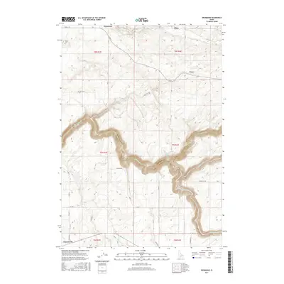
2017 Map of Drummond
USGS Topo · Published 2017About this map
Drummond serves as a key settlement point on the high plains of eastern Idaho, situated just north of where the Fremont Co Teton Co border follows the deep, meandering canyons of Bitch Creek and the Teton River. The landscape transition is stark, shifting from the flat agricultural grid of the north to the dramatic, eroded drainage systems of the N Fork Teton River and Badger Creek. This 2017 survey reveals a rural infrastructure defined by long, straight sections such as Hog Hollow Rd and Anderson Rd, while naming small historic locales like France and Clementsville. Genealogists may find particular value in the Farnum Cem located near the northwestern corner, while the presence of Power Plant Rd near the river suggests the industrial importance of these watercourses for power generation in the region.
Find a feature on this map
27 named features on this map. Tap any name to fly to it.
Don’t see what you’re looking for? This feature index may not catch every label — zoom into the map to look around manually.
Map Details
Editions of this 2017 Drummond Map
This is the sole edition of this map. No revisions or reprints were ever made.
Other maps of this area

1955 · Ashton
USGS Topo · 1:250,000

1955 · Driggs
USGS Topo · 1:250,000

1957 · Warm River Butte
USGS Topo · 1:62,500

1958 · Driggs
USGS Topo · 1:250,000

1958 · Ashton
USGS Topo · 1:250,000

1960 · Ashton
USGS Topo · 1:250,000

1962 · Driggs
USGS Topo · 1:250,000

1965 · Lamont
USGS Topo · 1:24,000

1965 · Ashton
USGS Topo · 1:24,000

1965 · Packsaddle Lake
USGS Topo · 1:24,000