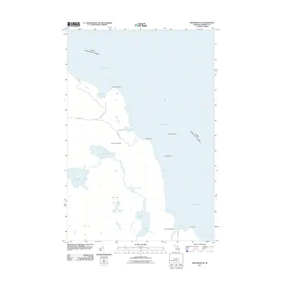
2011 Map of Drummond SE
USGS Topo · Published 2011About this map
The remote southeastern reaches of Drummond Island define this 2011 survey, where the international boundary between the United States and Canada cuts through the deep waters of Lake Huron. The landscape is dominated by a complex network of interior waterways and coastal features, including the winding Potagannissing River which connects a series of numbered basins from First Lake through to Fourth Lake. These secluded freshwater systems sit just inland from the rugged eastern shoreline, where landmarks like Raynolds Point and Shoal Point overlook the North Channel.
Find a feature on this map
28 named features on this map. Tap any name to fly to it.
Don’t see what you’re looking for? This feature index may not catch every label — zoom into the map to look around manually.
Map Details
Editions of this 2011 Drummond SE Map
This is the sole edition of this map. No revisions or reprints were ever made.
Other maps of this area

1954 · Alpena
USGS Topo · 1:250,000

1957 · Alpena
USGS Topo · 1:250,000

1958 · Alpena
USGS Topo · 1:250,000

1961 · Blind River
USGS Topo · 1:250,000
1964 · Marble Head
USGS Topo · 1:24,000

1964 · Drummond
USGS Topo · 1:24,000

1964 · Meade Island
USGS Topo · 1:24,000
1964 · Drummond SE
USGS Topo · 1:24,000
1968 · Blind River
USGS Topo · 1:250,000

1969 · Alpena
USGS Topo · 1:250,000