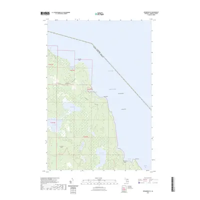
2023 Map of Drummond SE
USGS Topo · Published 2023About this map
Drummond Island marks the southeastern reach of the Michigan frontier, where the Lake Huron shoreline defines the international border between the United States and Canada. The landscape is dominated by the Maxton Plains, a distinctive limestone pavement ecosystem that transitions into a network of inland waters including First Lake, Second Lake, and Fourth Lake. Along the eastern coast, the terrain breaks into isolated points and coves such as Glen Point and Glen Cove, protected by offshore hazards like Humphrey Rock and Lindsay Bank. This modern survey reveals a sparsely populated interior where local travel relies on routes like the Drummond Island Trl and Canfield Blvd. The map illustrates the persistence of this isolated island geography, where large tracts of forest and wetlands meet the vast expanses of the North Channel.
Find a feature on this map
31 named features on this map. Tap any name to fly to it.
Don’t see what you’re looking for? This feature index may not catch every label — zoom into the map to look around manually.
Map Details
Editions of this 2023 Drummond SE Map
This is the sole edition of this map. No revisions or reprints were ever made.
Other maps of this area

1954 · Alpena
USGS Topo · 1:250,000

1957 · Alpena
USGS Topo · 1:250,000

1958 · Alpena
USGS Topo · 1:250,000

1961 · Blind River
USGS Topo · 1:250,000
1964 · Marble Head
USGS Topo · 1:24,000

1964 · Drummond
USGS Topo · 1:24,000

1964 · Meade Island
USGS Topo · 1:24,000
1964 · Drummond SE
USGS Topo · 1:24,000
1968 · Blind River
USGS Topo · 1:250,000

1969 · Alpena
USGS Topo · 1:250,000