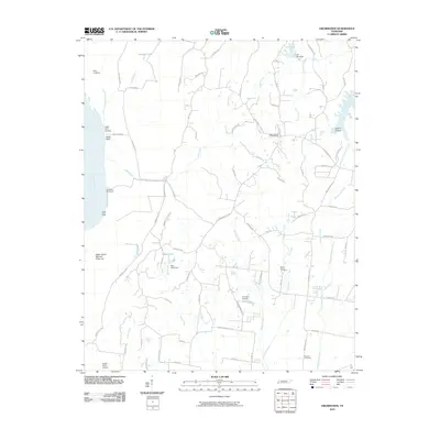
2010 Map of Drummonds
USGS Topo · Published 2010About this map
The Mississippi River defines the western edge of this landscape, where riverbank engineering like the Densford Revetment and Cedar Point Dikes manages the powerful current. Landings such as Neal Landing and Cedar Point Landing suggest the enduring importance of river access, while further inland, the terrain is shaped by a dense network of tributaries including Bear Creek, Hurricane Creek, and Cole Creek.
Find a feature on this map
79 named features on this map. Tap any name to fly to it.
Don’t see what you’re looking for? This feature index may not catch every label — zoom into the map to look around manually.
Map Details
Editions of this 2010 Drummonds Map
This is the sole edition of this map. No revisions or reprints were ever made.
Other maps of this area

1931 · Jericho
USGS Topo · 1:62,500

1939 · Jericho
USGS Topo · 1:62,500

1939 · Evadale
USGS Topo · 1:62,500

1942 · Millington
USGS Topo · 1:62,500

1952 · Jericho
USGS Topo · 1:62,500

1953 · Memphis
USGS Topo · 1:250,000

1956 · Evadale
USGS Topo · 1:62,500

1956 · Memphis
USGS Topo · 1:250,000

1956 · Blytheville
USGS Topo · 1:250,000

1959 · Blytheville
USGS Topo · 1:250,000