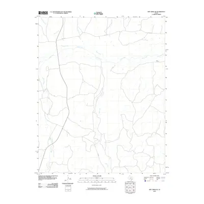
2010 Map of Dry Creek NE
USGS Topo · Published 2010About this map
The Canadian River meanders across the northern portion of this Roberts County landscape, carving a wide valley through the Texas Panhandle. This 2010 survey illustrates a sparsely settled ranching region defined more by its drainage networks than by urban centers. Local watercourses like Sourdough Creek, Dugout Creek, and West Dugout Creek feed into the river from the north, while the southern terrain is dominated by the long reach of Indian Creek and Chicken Creek. A solitary man-made landmark, the Red Windmill, stands near the eastern riverbank, serving as a vital reference point for local land management. Transportation is limited to rural routes such as Fm 283 and N River Rd, reflecting the expansive, open-range character of the territory during this era.
Find a feature on this map
12 named features on this map. Tap any name to fly to it.
Don’t see what you’re looking for? This feature index may not catch every label — zoom into the map to look around manually.
Map Details
Editions of this 2010 Dry Creek NE Map
This is the sole edition of this map. No revisions or reprints were ever made.
Other maps of this area

1954 · Perryton
USGS Topo · 1:250,000

1954 · Amarillo
USGS Topo · 1:250,000

1958 · Perryton
USGS Topo · 1:250,000

1958 · Amarillo
USGS Topo · 1:250,000

1971 · Dry Creek South
USGS Topo · 1:24,000

1971 · Dry Creek SE
USGS Topo · 1:24,000

1971 · Dry Creek NE
USGS Topo · 1:24,000

1971 · Dry Creek North
USGS Topo · 1:24,000

1972 · Horse Creek North
USGS Topo · 1:24,000
1972 · Horse Creek South
USGS Topo · 1:24,000