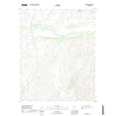
2019 Map of Dry Creek NE
USGS Topo · Published 2019About this map
The Canadian River cuts a wide, braided path across this Roberts County landscape, serving as the primary geological and logistical anchor for the surrounding panhandle terrain. This 2019 survey illustrates a region defined by extensive drainage networks, where numerous intermittent streams like Chicken Cr and Indian Cr flow toward the river valley through deeply dissected breaks. The network of ranch roads and rural routes, including N River Rd and Payne Ranch Rd, reflects the enduring legacy of large-scale cattle ranching in this part of Texas. Notable local landmarks like Picketts Ranch Cr and Sourdough Cr preserve the nomenclature of earlier frontier occupations and ranching operations. The presence of Fm 283 provides the main north-south artery through this sparsely populated but topographically complex area.
Find a feature on this map
15 named features on this map. Tap any name to fly to it.
Don’t see what you’re looking for? This feature index may not catch every label — zoom into the map to look around manually.
Map Details
Editions of this 2019 Dry Creek NE Map
This is the sole edition of this map. No revisions or reprints were ever made.
Other maps of this area

1954 · Perryton
USGS Topo · 1:250,000

1954 · Amarillo
USGS Topo · 1:250,000

1958 · Perryton
USGS Topo · 1:250,000

1958 · Amarillo
USGS Topo · 1:250,000

1971 · Dry Creek South
USGS Topo · 1:24,000

1971 · Dry Creek SE
USGS Topo · 1:24,000

1971 · Dry Creek NE
USGS Topo · 1:24,000

1971 · Dry Creek North
USGS Topo · 1:24,000

1972 · Horse Creek North
USGS Topo · 1:24,000
1972 · Horse Creek South
USGS Topo · 1:24,000