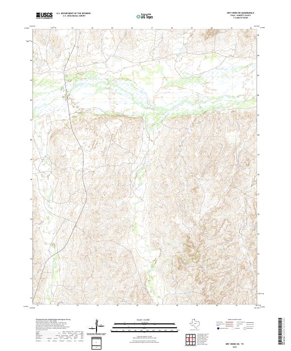
2022 Map of Dry Creek NE
USGS Topo · Published 2022About this map
The Canadian River flows through the northern reaches of this Roberts County landscape, creating a broad, complex corridor of water and sediment. This modern survey illustrates the rugged drainage systems of the Texas Panhandle, where numerous intermittent streams like Sourdough Cr, Picketts Ranch Cr, and Chicken Cr carve out the breaks leading toward the river valley. The map reveals a land defined by large-scale ranching operations and limited transit infrastructure, with Payne Ranch Rd and N River Rd providing the primary access through the territory. In the southern portion of the quadrangle, the headwaters of Indian Cr wind through deeply contoured terrain, highlighting the erosive forces that shape this semi-arid region. Isolated ranch tracks and roads such as Ledrick Rd and FM 283 trace the few accessible paths across the ridgelines and creek beds.
Find a feature on this map
15 named features on this map. Tap any name to fly to it.
Don’t see what you’re looking for? This feature index may not catch every label — zoom into the map to look around manually.
Map Details
Editions of this 2022 Dry Creek NE Map
This is the sole edition of this map. No revisions or reprints were ever made.
Other maps of this area

1954 · Perryton
USGS Topo · 1:250,000

1954 · Amarillo
USGS Topo · 1:250,000

1958 · Perryton
USGS Topo · 1:250,000

1958 · Amarillo
USGS Topo · 1:250,000

1971 · Dry Creek South
USGS Topo · 1:24,000

1971 · Dry Creek SE
USGS Topo · 1:24,000

1971 · Dry Creek NE
USGS Topo · 1:24,000

1971 · Dry Creek North
USGS Topo · 1:24,000

1972 · Horse Creek North
USGS Topo · 1:24,000
1972 · Horse Creek South
USGS Topo · 1:24,000