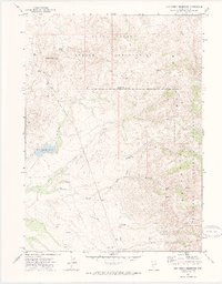
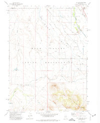
1971 Map of Dry Creek Reservoir
USGS Topo · Published 1974About this map
The northern reaches of Elko County are defined by the convergence of indigenous lands and national forest in this early 1970s survey. Much of the northern landscape is occupied by the Duck Valley Indian Reservation, where features like Paisewa Goei Rock and Granger Spring mark the high country. Water management is central to the area's geography, anchored by the Dry Creek Reservoir and a network of drainages including Indian Creek, Winters Creek, and Mitchell Creek. To the east, the terrain rises into the Humboldt National Forest, accessed by early routes through Porcupine Pass. Named gates like White Gate and Grows Nest Gate suggest a landscape managed for grazing and ranching, while a remote Borrow Pit indicates localized infrastructure efforts in this high-altitude basin.
Find a feature on this map
22 named features on this map. Tap any name to fly to it.
Don’t see what you’re looking for? This feature index may not catch every label — zoom into the map to look around manually.
Map Details
Editions of this 1971 Dry Creek Reservoir Map
2 editions found
Other maps of this area

1939 · Owyhee
USGS Topo · 1:62,500

1942 · Owyhee
USGS Topo · 1:62,500

1955 · McDermitt
USGS Topo · 1:250,000

1956 · Bull Run
USGS Topo · 1:62,500

1959 · McDermitt
USGS Topo · 1:250,000

1964 · Hat Peak
USGS Topo · 1:62,500

1964 · Wilson Reservoir
USGS Topo · 1:62,500
1970 · Ungina Wongo
USGS Topo · 1:24,000
1971 · Owyhee
USGS Topo · 1:24,000
1971 · The Point
USGS Topo · 1:24,000