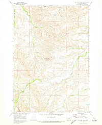
1969 Map of Dry Soap Creek
USGS Topo · Published 1973About this map
Soap Creek and its complex network of tributaries define this landscape within the boundary of the Crow Indian Reservation in Big Horn County. Surveyed at the close of the 1960s, the terrain shows a specialized ranching and energy landscape where a long Pipeline cuts across the upland divides. Local hydrology is detailed through numerous named drainages, including Rotten Grass Creek and the curiously named Packs The Hat Creek. The map documents high-elevation features like Cooper Basin and Boze, providing a clear record of the area's natural topography before modern developments. Researchers will find the drainage patterns of Willow Creek and Ash Coulee particularly well-defined, illustrating the erosional character of this part of the Missouri River Basin development program.
Find a feature on this map
11 named features on this map. Tap any name to fly to it.
Don’t see what you’re looking for? This feature index may not catch every label — zoom into the map to look around manually.
Map Details
Editions of this 1969 Dry Soap Creek Map
This is the sole edition of this map. No revisions or reprints were ever made.
Other maps of this area

1894 · St. Xavier
USGS Topo · 1:125,000

1901 · St. Xavier
USGS Topo · 1:125,000

1954 · Hardin
USGS Topo · 1:250,000

1957 · Hardin
USGS Topo · 1:250,000

1958 · Hardin
USGS Topo · 1:250,000

1960 · Schick Ranch
USGS Topo · 1:24,000

1960 · Mission Coulee
USGS Topo · 1:24,000
1964 · Mountain Pocket Creek
USGS Topo · 1:24,000
1969 · Willow Creek Dam SW
USGS Topo · 1:24,000
1969 · Black Gulch
USGS Topo · 1:24,000