
1960 Map of Mission Coulee
USGS Topo · Published 1962About this map
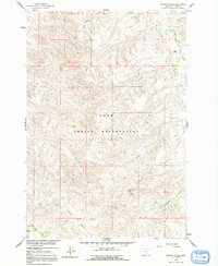
Mission Coulee cuts through a landscape defined by deep drainages and cattle ranching in Big Horn County during the early 1960s. Surveyed as part of a Department of the Interior program for the development of the Missouri River Basin, the map captures the remote ranching operations of the Siemion Ranch and Wolf Ranch. The terrain is characterized by a series of significant coulees and basins, including West Dipping Vat Coulee and Cooper Basin, which historically served as vital corridors for livestock movement and water access in this semi-arid environment. Prominent landmarks such as Rattlesnake Butte provide orientation points across the high ground between the drainage systems of Rotten Grass Creek and Soap Creek. The presence of fence lines and unimproved roads across this topography reflects the mid-century land use patterns of the Crow Indian Reservation region before significant modern development.
Find a feature on this map
13 named features on this map. Tap any name to fly to it.
Don’t see what you’re looking for? This feature index may not catch every label — zoom into the map to look around manually.
Map Details
Editions of this 1960 Mission Coulee Map
2 editions found
Other maps of this area

1894 · St. Xavier
USGS Topo · 1:125,000

1901 · St. Xavier
USGS Topo · 1:125,000

1954 · Hardin
USGS Topo · 1:250,000

1957 · Hardin
USGS Topo · 1:250,000

1958 · Hardin
USGS Topo · 1:250,000

1960 · Schick Ranch
USGS Topo · 1:24,000

1960 · St Xavier
USGS Topo · 1:24,000

1960 · St Xavier NE
USGS Topo · 1:24,000
1964 · Mountain Pocket Creek
USGS Topo · 1:24,000
1969 · Willow Creek Dam
USGS Topo · 1:24,000