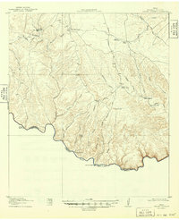
1918 Map of Dryden Crossing
USGS Topo · Published 1949About this map
The Rio Grande carves the southern boundary of this remote Terrell County landscape, where the international border separates Texas from Mexico. Surveyed in 1917, the map illustrates a rugged ranching economy defined by isolated outposts such as Coffin Ranch, Miller Ranch, and McClain Ranch. Transportation in this era relied on critical river passages like Shafer Crossing and the Cable Crossing Road, connecting the inland plateaus to the river valley. The terrain is deeply dissected by a network of drainage systems, including Sanderson Canyon and Seminole Canyon, which channel toward the border. In an arid environment, life clustered around reliable water sources like the Blue Water Hole and Middle Watering, which served as vital landmarks for travelers and stockmen navigating between the Cable Hills and the Shafter Hills.
Find a feature on this map
32 named features on this map. Tap any name to fly to it.
Don’t see what you’re looking for? This feature index may not catch every label — zoom into the map to look around manually.
Map Details
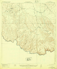
Editions of this 1918 Dryden Crossing Map
3 editions found
Other maps of this area

1918 · Dryden Crossing
USGS Topo · 1:62,500

1918 · Indian Wells
USGS Topo · 1:62,500

1928 · Sanderson
USGS Topo · 1:125,000

1943 · Malvado
USGS Topo · 1:62,500

1944 · Malvado
USGS Topo · 1:62,500

1954 · Fort Stockton
USGS Topo · 1:250,000

1954 · Sonora
USGS Topo · 1:250,000

1958 · Sonora
USGS Topo · 1:250,000

1958 · Fort Stockton
USGS Topo · 1:250,000

1958 · Del Rio
USGS Topo · 1:250,000