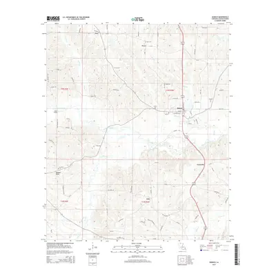
2015 Map of Dubach
USGS Topo · Published 2015About this map
Dubach and the surrounding Lincoln Parish terrain are defined by the winding course of Bayou D'Arbonne and its numerous tributaries. This 2015 U.S. Geological Survey representation details a rural landscape where small settlements like Hico, Unionville, and Hilly are connected by a network of state routes and local roads such as La-545 and Hico Loop Rd. The map is particularly useful for genealogical research, identifying several family-named and local burial grounds including Henry Cem, Autrey Cem, and Providence Cem. The drainage patterns of Turkey Cr and Big Creek illustrate the low-lying hydrology that characterizes the region north of Ruston, while landmarks like Mays Bridge provide specific points of reference for navigating the waterways that dissect the local townships.
Find a feature on this map
71 named features on this map. Tap any name to fly to it.
Don’t see what you’re looking for? This feature index may not catch every label — zoom into the map to look around manually.
Map Details
Editions of this 2015 Dubach Map
This is the sole edition of this map. No revisions or reprints were ever made.
Other maps of this area

1950 · Ruston
USGS Topo · 1:62,500

1950 · Arcadia
USGS Topo · 1:62,500

1951 · Arcadia
USGS Topo · 1:62,500

1951 · Ruston
USGS Topo · 1:62,500

1951 · Summerfield
USGS Topo · 1:62,500

1951 · Bernice
USGS Topo · 1:62,500

1955 · Shreveport
USGS Topo · 1:250,000

1956 · Shreveport
USGS Topo · 1:250,000

1984 · Shreveport
USGS Topo · 1:250,000

1985 · Monroe North
USGS Topo · 1:100,000