2024 Map of Dubach
USGS Topo · Published 2024About this map
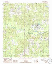
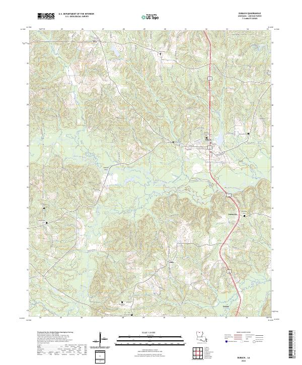
Bayou D'Arbonne carves a winding path across this portion of Lincoln Parish, defining a landscape shaped by its river systems and early settlement patterns. In the north, the town of Dubach serves as a central hub, where local streets like Hico St and Boulevard St meet the corridor of Highway 167. The map reveals a high concentration of small family and community burial grounds, including the Hamilton Memorial Cem and Autrey Cem, which are invaluable for genealogical research in this rural region.
Find a feature on this map
75 named features on this map. Tap any name to fly to it.
Don’t see what you’re looking for? This feature index may not catch every label — zoom into the map to look around manually.
Map Details
Editions of this 2024 Dubach Map
This is the sole edition of this map. No revisions or reprints were ever made.