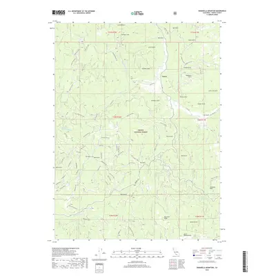
2018 Map of Dubakella Mountain
USGS Topo · Published 2018About this map
Peanut serves as a central point in this mountain landscape, which is defined by the complex drainage systems within the Trinity National Forest. The map details a rugged topography where high points like Plummer Peak and Dubakella Mtn overlook numerous gulches and creeks. A dense network of forest routes and local roads, such as Plummer Lookout Rd and the evocatively named 13 Dips Rd, reveal the historical access required for fire lookouts and land management. The presence of Plummer Spring and the branching of Philpot Cr and Salt Cr illustrate the vital water sources that shaped local geography. This survey provides a clear view of the transition between the high ridges of Blue Point Ridge and the deep incisions of Dry Gulch and Bule Gulch, reflecting the region's enduring character as a managed timber and recreation area in the early 21st century.
Find a feature on this map
84 named features on this map. Tap any name to fly to it.
Don’t see what you’re looking for? This feature index may not catch every label — zoom into the map to look around manually.
Map Details
Editions of this 2018 Dubakella Mountain Map
This is the sole edition of this map. No revisions or reprints were ever made.
Other maps of this area

1909 · Big Bar
USGS Topo · 1:96,000

1915 · Big Bar and Vicinity
USGS Topo · 1:250,000

1918 · Anada
USGS Topo · 1:62,500

1931 · Hoaglin
USGS Topo · 1:96,000

1935 · Hoaglin
USGS Topo · 1:125,000

1951 · Hayfork
USGS Topo · 1:62,500

1951 · Hyampom
USGS Topo · 1:62,500

1954 · Pickett Peak
USGS Topo · 1:62,500

1954 · Dubakella Mtn
USGS Topo · 1:62,500

1958 · Redding
USGS Topo · 1:250,000