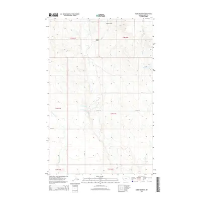
2014 Map of Dubbe Reservoir
USGS Topo · Published 2014About this map
The high plains of Valley County north of the Milk River are defined by a complex network of ephemeral drainages and intermittent water sources. This 2014 survey documents a landscape of sparse ranching infrastructure where water management is critical to land use. Dubbe Reservoir and Horgan Reservoir serve as vital catchments in an area otherwise marked by seasonal features like Johnson Coulee and Oswego Cr. The map reveals specific hydrographic data points such as 28N44E17CCBD01 Spring and 28N44E17CCCD01 Spring, which alongside W Fork Charley Cr, illustrate the drainage patterns of the Frazer district. Transportation in this section of the Missouri River country is limited to section-line routes like W Granada Rd and Ivy Coulee Rd, highlighting the remote character of these township boundaries.
Find a feature on this map
15 named features on this map. Tap any name to fly to it.
Don’t see what you’re looking for? This feature index may not catch every label — zoom into the map to look around manually.
Map Details
Editions of this 2014 Dubbe Reservoir Map
This is the sole edition of this map. No revisions or reprints were ever made.
Other maps of this area

1910 · Todd Lakes
USGS Topo · 1:62,500

1915 · Frazer
USGS Topo · 1:62,500

1915 · Oswego
USGS Topo · 1:62,500

1915 · Todd Lakes
USGS Topo · 1:62,500

1915 · Spring Creek
USGS Topo · 1:62,500

1954 · Wolf Point
USGS Topo · 1:250,000

1954 · Glasgow
USGS Topo · 1:250,000

1957 · Glasgow
USGS Topo · 1:250,000

1958 · Wolf Point
USGS Topo · 1:250,000

1958 · Glasgow
USGS Topo · 1:250,000