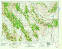
1955 Map of Dubois
USGS Topo · Published 1963About this map
The Beaverhead Mountains and Bitterroot Mountains form a massive natural boundary along the Montana and Idaho border, anchoring a landscape of high-altitude basins and significant water management projects. At the southern edge of the survey, the National Reactor Testing Station occupies a portion of the Snake River Plain, marking the era's emerging atomic energy footprint. To the north, engineering feats like the Clark Canyon Dam and Lima Reservoir illustrate mid-century efforts to harness the Red Rock River for regional irrigation and power.
Find a feature on this map
44 named features on this map. Tap any name to fly to it.
Don’t see what you’re looking for? This feature index may not catch every label — zoom into the map to look around manually.
Map Details
Editions of this 1955 Dubois Map
4 editions found


Other maps of this area

1888 · Three Forks
USGS Topo · 1:250,000

1893 · Dillon
USGS Topo · 1:250,000

1894 · Three Forks
USGS Topo · 1:250,000

1895 · Three Forks
USGS Topo · 1:250,000

1895 · Hailey
USGS Topo · 1:125,000

1897 · Hailey
USGS Topo · 1:125,000

1929 · Bayhorse
USGS Topo · 1:125,000

1935 · MacKay
USGS Topo · 1:96,000

1935 · Borah Peak
USGS Topo · 1:125,000

1938 · Borah Peak
USGS Topo · 1:125,000