
1955 Map of Dubois
USGS Topo · Published 1955About this map
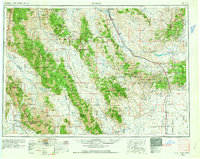
The Continental Divide snake-like path defines the high-altitude topography of this 1955 survey, marking the jagged spine of the Beaverhead Mountains and separating the drainages of Idaho and Montana. The region is characterized by immense north-south mountain ranges including the Lemhi Range and Lost River Range, which hem in significant valleys like the Thousand Springs Valley. Along the eastern plains, the industrial and scientific footprint of the mid-20th century is evident at the National Reactor Testing Station and the United States Sheep Experiment Station near Dubois.
Find a feature on this map
60 named features on this map. Tap any name to fly to it.
Don’t see what you’re looking for? This feature index may not catch every label — zoom into the map to look around manually.
Map Details
Editions of this 1955 Dubois Map
4 editions found

Other maps of this area

1888 · Three Forks
USGS Topo · 1:250,000

1893 · Dillon
USGS Topo · 1:250,000

1894 · Three Forks
USGS Topo · 1:250,000

1895 · Three Forks
USGS Topo · 1:250,000

1895 · Hailey
USGS Topo · 1:125,000

1897 · Hailey
USGS Topo · 1:125,000

1929 · Bayhorse
USGS Topo · 1:125,000

1935 · MacKay
USGS Topo · 1:96,000

1935 · Borah Peak
USGS Topo · 1:125,000

1938 · Borah Peak
USGS Topo · 1:125,000