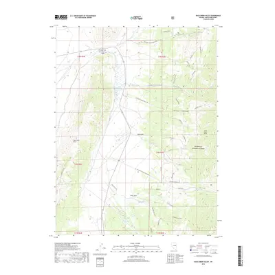
2018 Map of Duck Creek Valley
USGS Topo · Published 2018About this map
Duck Creek Valley is defined by the significant corridor between the Duck Creek Range and the Schell Creek Range within the Humboldt National Forest. Central to this high-desert landscape is the Duck Cr Reservoir, which gathers drainage from surrounding heights like Gallagher Gap. The map documents a complex network of resource and recreational routes, including the Brennan Mine Loop and the Ranger Trail, alongside smaller water sources such as Wishbone Wells and Pat and Mike Springs. The transition from the valley floor to the protected Mule Deer Wilderness illustrates the area's management for both wildlife and watershed protection, evidenced by the presence of a Deer Studies Plot near Berry Cr.
Find a feature on this map
48 named features on this map. Tap any name to fly to it.
Don’t see what you’re looking for? This feature index may not catch every label — zoom into the map to look around manually.
Map Details
Editions of this 2018 Duck Creek Valley Map
This is the sole edition of this map. No revisions or reprints were ever made.
Other maps of this area

1952 · Ely
USGS Topo · 1:125,000

1956 · Ely
USGS Topo · 1:250,000

1958 · McGill
USGS Topo · 1:24,000

1958 · East Ely
USGS Topo · 1:24,000

1958 · McGill
USGS Topo · 1:62,500

1959 · Ely
USGS Topo · 1:250,000

1959 · Schell Peaks
USGS Topo · 1:62,500

1963 · Ely
USGS Topo · 1:250,000

1981 · North Schell Peak
USGS Topo · 1:24,000

1981 · Duck Creek Valley
USGS Topo · 1:24,000