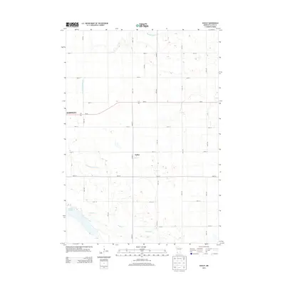
2013 Map of Dudley
USGS Topo · Published 2013About this map
Redwood River meanders across the northern portion of this Lyon County landscape, which remains defined by its agricultural grid and complex water management. The small settlement of Dudley occupies a central position at the intersection of Co Hwy-9 and 260th St, while the eastern fringes of Marshall appear along the western boundary. This 2013 survey illustrates the heavy reliance on drainage infrastructure in southwestern Minnesota, most notably the prominent County Ditch Number Sixty which cuts through the prairie toward Meadow Cr. In the southwest corner, Lake Marshall serves as a significant natural landmark amidst a network of rural roads like 330th Ave and MN-68 that connect the isolated farmsteads and fields of the region.
Find a feature on this map
24 named features on this map. Tap any name to fly to it.
Don’t see what you’re looking for? This feature index may not catch every label — zoom into the map to look around manually.
Map Details
Editions of this 2013 Dudley Map
This is the sole edition of this map. No revisions or reprints were ever made.
Other maps of this area

1953 · New Ulm
USGS Topo · 1:250,000

1957 · New Ulm
USGS Topo · 1:250,000

1958 · New Ulm
USGS Topo · 1:250,000

1962 · Dudley
USGS Topo · 1:24,000

1962 · Cottonwood
USGS Topo · 1:24,000

1962 · School Grove Lake
USGS Topo · 1:24,000

1962 · Milroy SE
USGS Topo · 1:24,000

1962 · Amiret
USGS Topo · 1:24,000

1962 · Milroy
USGS Topo · 1:24,000

1963 · Marshall SE
USGS Topo · 1:24,000