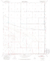
1954 Map of Dudley Ridge
USGS Topo · Published 1985About this map
Tulare Lake Bed dominates the northern half of this landscape, its flat expanse partitioned by an extensive network of drainage infrastructure. Long Levee systems and irrigation works like the Blakeley Canal and Utica Avenue Canal illustrate the intensive mid-century efforts to manage the water of the San Joaquin Valley. To the south, the terrain rises into the distinct formation of Dudley Ridge, providing a stark contrast to the low-lying lake bed. The map reveals a specialized agricultural environment where water control is paramount, evidenced by numerous pumps and a prominent Pipe Line cutting through the western sections. Houser Camp appears as a rare point of named habitation in this industrial-scale landscape, offering a specific location for genealogists or local historians tracing those who worked and lived on the ridge during the 1950s.
Find a feature on this map
19 named features on this map. Tap any name to fly to it.
Don’t see what you’re looking for? This feature index may not catch every label — zoom into the map to look around manually.
Map Details
Editions of this 1954 Dudley Ridge Map
3 editions found
Other maps of this area

1914 · Lost Hills
USGS Topo · 1:125,000

1930 · Avenal Gap
USGS Topo · 1:31,680

1930 · Middle Dome
USGS Topo · 1:31,680

1931 · Harvester
USGS Topo · 1:31,680

1932 · El Rico Ranch
USGS Topo · 1:31,680

1932 · Dudley Ridge
USGS Topo · 1:31,680

1932 · West Camp
USGS Topo · 1:31,680

1932 · Lone Tree Well
USGS Topo · 1:31,680

1933 · Avenal Gap
USGS Topo · 1:31,680

1933 · Kettleman City
USGS Topo · 1:31,680