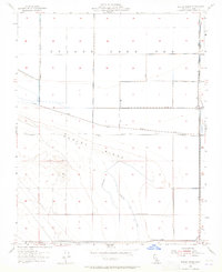
1954 Map of Dudley Ridge
USGS Topo · Published 1965About this map
Tulare Lake Bed dominates this landscape, reflecting a time when the once-massive freshwater lake had been largely converted to agricultural land through an intensive system of reclamation. The map shows the grid-like precision of water management in the San Joaquin Valley, where the Blakeley Canal, multiple Levee systems, and various Ditch networks dictated the flow across the basin. The southern portion of the sheet is defined by the subtle rise of Dudley Ridge, which contrasts with the flat, low-lying lake bed to the north. Evidence of the region’s industrial and agricultural infrastructure is found in the Pipe Line running through the southwest and the isolated outpost of Houser Camp near the eastern edge. Local travel is facilitated by corridors like Utica Avenue, while several benchmark locations such as BM 199 and BM 194 indicate the precise surveying required for irrigation and flood control in this reclaimed territory.
Find a feature on this map
18 named features on this map. Tap any name to fly to it.
Don’t see what you’re looking for? This feature index may not catch every label — zoom into the map to look around manually.
Map Details
Editions of this 1954 Dudley Ridge Map
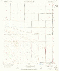
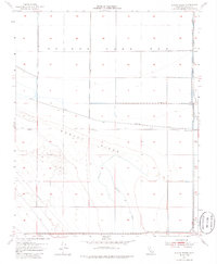
3 editions found
Other maps of this area

1914 · Lost Hills
USGS Topo · 1:125,000

1930 · Avenal Gap
USGS Topo · 1:31,680

1930 · Middle Dome
USGS Topo · 1:31,680

1931 · Harvester
USGS Topo · 1:31,680

1932 · El Rico Ranch
USGS Topo · 1:31,680

1932 · Dudley Ridge
USGS Topo · 1:31,680

1932 · West Camp
USGS Topo · 1:31,680

1932 · Lone Tree Well
USGS Topo · 1:31,680

1933 · Avenal Gap
USGS Topo · 1:31,680

1933 · Kettleman City
USGS Topo · 1:31,680