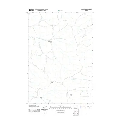
2011 Map of Dudley Spring
USGS Topo · Published 2011About this map
Old Ford Place serves as a key landmark in this Big Horn County landscape, where the branching drainage systems of Pocket Creek and Cottonwood Creek dominate the topography. The area is defined by a series of coulees and flats, including Rough Springs Coulee to the north and the expansive Poverty Flats to the south. This terrain illustrates the characteristic watershed patterns of the Montana plains, with numerous seasonal and perennial forks such as West Burnt Creek and North Cottonwood Creek carving through the prairie. The network of light-duty roads and tracks suggests a rural ranching or agricultural environment, connecting isolated points like Hoshow Coulee to the broader regional geography.
Find a feature on this map
12 named features on this map. Tap any name to fly to it.
Don’t see what you’re looking for? This feature index may not catch every label — zoom into the map to look around manually.
Map Details
Editions of this 2011 Dudley Spring Map
This is the sole edition of this map. No revisions or reprints were ever made.
Other maps of this area

1894 · Fort Custer
USGS Topo · 1:125,000

1954 · Hardin
USGS Topo · 1:250,000

1954 · Forsyth
USGS Topo · 1:250,000

1957 · Hardin
USGS Topo · 1:250,000

1957 · Forsyth
USGS Topo · 1:250,000

1958 · Forsyth
USGS Topo · 1:250,000

1958 · Hardin
USGS Topo · 1:250,000

1960 · Foster
USGS Topo · 1:24,000

1960 · Ninemile Point
USGS Topo · 1:24,000

1960 · Marsh Coulee
USGS Topo · 1:24,000