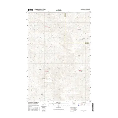
2017 Map of Dudley Spring
USGS Topo · Published 2017About this map
Dudley Spring and the expansive drainage systems of the Montana high country define this portion of the border between Big Horn and Treasure counties. The landscape is characterized by deeply incised seasonal watercourses, including the evocatively named Fountain of Youth Coulee and Horse Pasture Coulee. Settlement patterns in this ranching environment are scattered, with topographical features like Poverty Flats and Sawmill Draw suggesting the historic land use and agricultural challenges of the region. The map reveals the intricate network of the N Fork Pocket Creek and S Fork Cottonwood Creek, illustrating how water sources dictate the geography of this arid northern plain. Researchers can trace the complex system of coulees such as Rough Springs Coulee and Smith Coulee that branch across the townships, providing a clear picture of the natural boundaries that shaped local grazing and land claims.
Find a feature on this map
25 named features on this map. Tap any name to fly to it.
Don’t see what you’re looking for? This feature index may not catch every label — zoom into the map to look around manually.
Map Details
Editions of this 2017 Dudley Spring Map
This is the sole edition of this map. No revisions or reprints were ever made.
Other maps of this area

1894 · Fort Custer
USGS Topo · 1:125,000

1954 · Hardin
USGS Topo · 1:250,000

1954 · Forsyth
USGS Topo · 1:250,000

1957 · Hardin
USGS Topo · 1:250,000

1957 · Forsyth
USGS Topo · 1:250,000

1958 · Forsyth
USGS Topo · 1:250,000

1958 · Hardin
USGS Topo · 1:250,000

1960 · Foster
USGS Topo · 1:24,000

1960 · Ninemile Point
USGS Topo · 1:24,000

1960 · Marsh Coulee
USGS Topo · 1:24,000