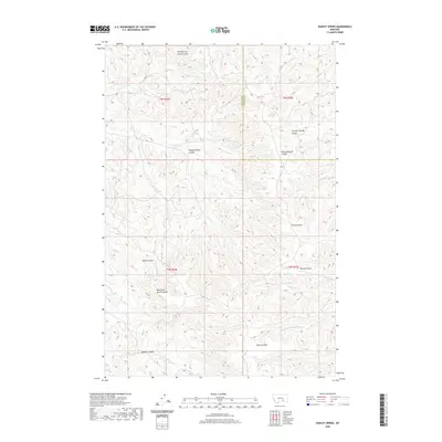
2020 Map of Dudley Spring
USGS Topo · Published 2020About this map
Dudley Spring and the surrounding drainage basins define this landscape along the border of Big Horn and Treasure Counties. The terrain is a complex network of coulees and draws, featuring the curiously named Fountain of Youth Coulee in the north and the expansive Poverty Flats to the south. These names suggest a history of early ranching and land use, where water sources were vital for livestock and survival. The drainage pattern is dictated by Cottonwood Cr and its various branches, including the N Cottonwood Cr and S Fork Cottonwood Cr. Other significant landmarks such as Summer Springs Coulee and Horse Pasture Coulee point to the area's utility as grazing land. This 2020 survey captures the intersection of several townships, including t3n r34e and t2n r35e, providing a clear look at the modern boundaries and hydraulic features of this part of Montana.
Find a feature on this map
24 named features on this map. Tap any name to fly to it.
Don’t see what you’re looking for? This feature index may not catch every label — zoom into the map to look around manually.
Map Details
Editions of this 2020 Dudley Spring Map
This is the sole edition of this map. No revisions or reprints were ever made.
Other maps of this area

1894 · Fort Custer
USGS Topo · 1:125,000

1954 · Hardin
USGS Topo · 1:250,000

1954 · Forsyth
USGS Topo · 1:250,000

1957 · Hardin
USGS Topo · 1:250,000

1957 · Forsyth
USGS Topo · 1:250,000

1958 · Forsyth
USGS Topo · 1:250,000

1958 · Hardin
USGS Topo · 1:250,000

1960 · Foster
USGS Topo · 1:24,000

1960 · Ninemile Point
USGS Topo · 1:24,000

1960 · Marsh Coulee
USGS Topo · 1:24,000