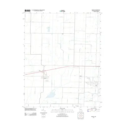
2011 Map of Dudley
USGS Topo · Published 2011About this map
Dudley and the rural surroundings of western Stoddard County are defined by a strictly surveyed grid of county roads and drainage waterways. The town of Dudley itself sits just south of Old Hwy 60, where a small cluster of streets including Main St and Stone St support the local community. To the south, a Landing Strip serves the agricultural aviation needs of a landscape dominated by flat, productive fields. The water system is characterized by channelized routes like Lick Creek, Spring Creek, and Cane Creek, which manage the drainage of this low-lying area.
Find a feature on this map
65 named features on this map. Tap any name to fly to it.
Don’t see what you’re looking for? This feature index may not catch every label — zoom into the map to look around manually.
Map Details
Editions of this 2011 Dudley Map
This is the sole edition of this map. No revisions or reprints were ever made.
Other maps of this area

1934 · Bloomfield
USGS Topo · 1:62,500

1934 · Puxico
USGS Topo · 1:62,500

1939 · Bloomfield
USGS Topo · 1:62,500

1939 · Puxico
USGS Topo · 1:62,500

1940 · Malden
USGS Topo · 1:62,500

1940 · Valley Ridge
USGS Topo · 1:62,500

1949 · Bloomfield
USGS Topo · 1:62,500

1956 · Valley Ridge
USGS Topo · 1:62,500

1956 · Malden
USGS Topo · 1:62,500

1956 · Dyersburg
USGS Topo · 1:250,000