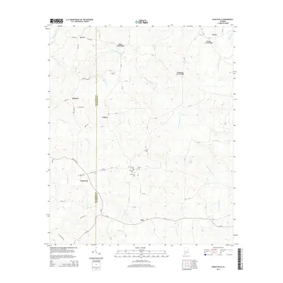
2014 Map of Dudleyville
USGS Topo · Published 2014About this map
Dudleyville and the surrounding rural landscapes of Chambers and Tallapoosa counties are defined by a network of historic crossroads and family cemeteries. Small settlements like Tiller Crossroads, Foster Crossroads, and Trammel Crossroads anchor the upland ridges between the winding paths of Chatahospee Cr and Little Chatahospee Cr. The map reveals a dense concentration of burial sites, including New Harmony Cem, Waites Cem, and Old Harmony Cem, which speak to the long-standing community foundations in this part of east-central Alabama. The terrain is marked by numerous small tributaries like McCowan Cr and Hunter Cr, feeding into larger waterways such as the Tallapoosa River. This late-twentieth-century landscape preserves the traditional road patterns and property boundaries that have shaped local life for generations.
Find a feature on this map
76 named features on this map. Tap any name to fly to it.
Don’t see what you’re looking for? This feature index may not catch every label — zoom into the map to look around manually.
Map Details
Editions of this 2014 Dudleyville Map
This is the sole edition of this map. No revisions or reprints were ever made.
Other maps of this area

1891 · Ashland
USGS Topo · 1:125,000

1899 · Wedowee
USGS Topo · 1:125,000

1902 · Wedowee
USGS Topo · 1:125,000

1906 · Dadeville
USGS Topo · 1:125,000

1907 · Opelika
USGS Topo · 1:125,000

1909 · Opelika
USGS Topo · 1:125,000

1953 · Atlanta
USGS Topo · 1:250,000

1955 · Phenix City
USGS Topo · 1:250,000

1957 · Phenix City
USGS Topo · 1:250,000

1957 · Atlanta
USGS Topo · 1:250,000