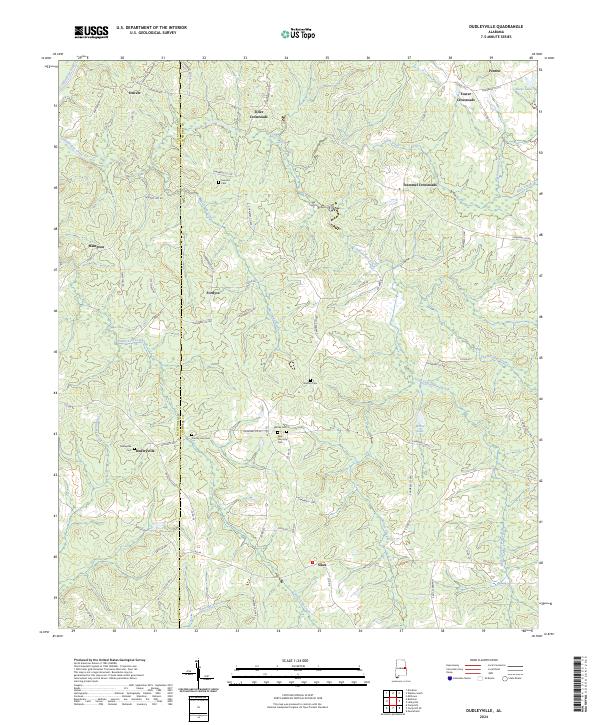
2024 Map of Dudleyville
USGS Topo · Published 2024About this map
Dudleyville and its surrounding crossroads anchor this rural landscape along the boundary of Tallapoosa and Chambers Counties. The area is characterized by a series of long-established family and community burial grounds, including the New Harmony Cem, Waites Cem, and Sanders Cem, which serve as vital markers for local genealogical research. The terrain is deeply etched by a network of waterways, with the Tallapoosa River clipping the northwest corner and the Chatahospee Creek winding through the center. Small settlements such as Fordyce, Denver, and Hampton are connected by a web of county roads like Chisholm Rd and Milltown Rd. These routes converge at historical junctions like Foster Crossroads and Trammel Crossroads, reflecting a settlement pattern based on rural agricultural connectivity and local commerce centers that have persisted into the modern era.
Find a feature on this map
79 named features on this map. Tap any name to fly to it.
Don’t see what you’re looking for? This feature index may not catch every label — zoom into the map to look around manually.
Map Details
Editions of this 2024 Dudleyville Map
This is the sole edition of this map. No revisions or reprints were ever made.
Other maps of this area

1891 · Ashland
USGS Topo · 1:125,000

1899 · Wedowee
USGS Topo · 1:125,000

1902 · Wedowee
USGS Topo · 1:125,000

1906 · Dadeville
USGS Topo · 1:125,000

1907 · Opelika
USGS Topo · 1:125,000

1909 · Opelika
USGS Topo · 1:125,000

1953 · Atlanta
USGS Topo · 1:250,000

1955 · Phenix City
USGS Topo · 1:250,000

1957 · Phenix City
USGS Topo · 1:250,000

1957 · Atlanta
USGS Topo · 1:250,000