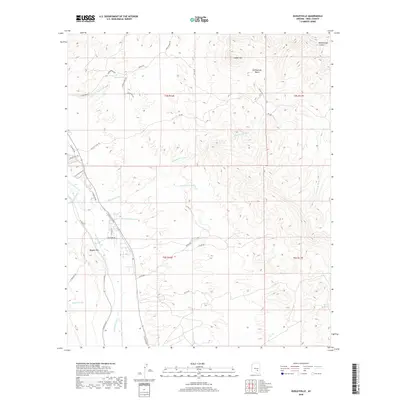
2018 Map of Dudleyville
USGS Topo · Published 2018About this map
The San Pedro River corridor defines the western edge of this Pinal County landscape, serving as a vital riparian artery through a terrain carved by numerous ephemeral drainages. The map reveals a complex network of seasonal waterways, including the winding Eskiminzin Wash, Green Lantern Wash, and Piper Springs Wash, which all flow toward the river valley. Higher elevations to the north and east are marked by prominent landforms such as Saddle Mtn, Rattlesnake Basin, and the deep incision of Rattlesnake Canyon. This survey captures the transition from the river bottomlands, where residential streets like N Cholla St and N Valentine Rd are established, to the high desert plateaus. Water sources like Piper Springs and Carrico Spring remain key landmarks for understanding the historical and ecological development of this arid region.
Find a feature on this map
39 named features on this map. Tap any name to fly to it.
Don’t see what you’re looking for? This feature index may not catch every label — zoom into the map to look around manually.
Map Details
Editions of this 2018 Dudleyville Map
This is the sole edition of this map. No revisions or reprints were ever made.
Other maps of this area

1910 · Ray
USGS Topo · 1:62,500

1911 · Winkelman
USGS Topo · 1:125,000

1913 · Winkelman
USGS Topo · 1:125,000

1915 · Christmas
USGS Topo · 1:62,500

1917 · Christmas
USGS Topo · 1:62,500

1949 · Holy Joe Peak
USGS Topo · 1:62,500

1949 · Winkelman
USGS Topo · 1:24,000

1949 · Winkelman
USGS Topo · 1:62,500

1949 · Saddle Mtn.
USGS Topo · 1:24,000

1949 · Brandenburg Mtn
USGS Topo · 1:24,000