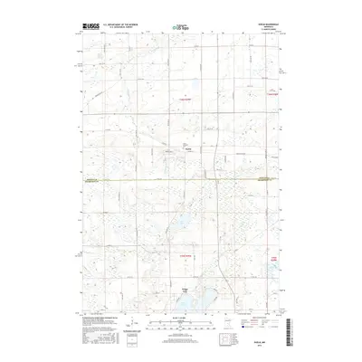
2016 Map of Duelm
USGS Topo · Published 2016About this map
Duelm sits at the center of this rural landscape, which is defined by the complex water systems of southern Benton County. The area is characterized by a high density of small wetlands and larger bodies of water, including Rice Lake and the interconnected chain of Briggs Lake and Julia Lake. These waterways are fed by meandering channels like Stony Brook and Rice Creek, which drain toward the south. The settlement pattern follows a rigid section-line grid typical of the Midwest, with established routes like Co Hwy 10 and Duelm Rd SE connecting the scattered farmsteads. Near the town center, the Saint Lawrence Cem provides a specific point of interest for genealogists tracking family histories in Saint George Township. The boundary between Benton Co Sherburne Co runs along the lower third of the map, separating the lake district from the northern reaches of Sherburne County.
Find a feature on this map
60 named features on this map. Tap any name to fly to it.
Don’t see what you’re looking for? This feature index may not catch every label — zoom into the map to look around manually.
Map Details
Editions of this 2016 Duelm Map
This is the sole edition of this map. No revisions or reprints were ever made.
Other maps of this area

1950 · St. Cloud
USGS Topo · 1:62,500

1951 · Annandale
USGS Topo · 1:62,500

1953 · Saint Cloud
USGS Topo · 1:250,000

1953 · Stillwater
USGS Topo · 1:250,000

1955 · Stillwater
USGS Topo · 1:250,000

1957 · Saint Cloud
USGS Topo · 1:250,000

1958 · Stillwater
USGS Topo · 1:250,000

1958 · Saint Cloud
USGS Topo · 1:250,000

1961 · Clear Lake
USGS Topo · 1:24,000

1961 · Becker
USGS Topo · 1:24,000