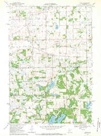
1968 Map of Duelm
USGS Topo · Published 1970About this map
Duelm sits near the center of this rural Minnesota landscape, established where the townships of Storge, Palmer, and Glendorado meet. This late 1960s survey documents a region defined by its glacial lakes and a transition from agriculture to recreational water use. The southern portion of the map is dominated by a chain of water bodies including Rice Lake, Briggs Lake, and Julia Lake, where early public Boat Ramp access points are already marked.
Find a feature on this map
18 named features on this map. Tap any name to fly to it.
Don’t see what you’re looking for? This feature index may not catch every label — zoom into the map to look around manually.
Map Details
Editions of this 1968 Duelm Map
This is the sole edition of this map. No revisions or reprints were ever made.
Other maps of this area

1950 · St. Cloud
USGS Topo · 1:62,500

1951 · Annandale
USGS Topo · 1:62,500

1953 · Saint Cloud
USGS Topo · 1:250,000

1953 · Stillwater
USGS Topo · 1:250,000

1955 · Stillwater
USGS Topo · 1:250,000

1957 · Saint Cloud
USGS Topo · 1:250,000

1958 · Stillwater
USGS Topo · 1:250,000

1958 · Saint Cloud
USGS Topo · 1:250,000

1961 · Clear Lake
USGS Topo · 1:24,000

1961 · Becker
USGS Topo · 1:24,000