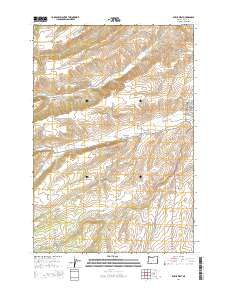
2014 Map of Dufur West
USGS Topo · Published 2014About this map
Dufur sits at the eastern edge of this landscape, where the street grid of N Main St and NE Akin St meets the winding course of Fifteenmile Cr. The terrain is defined by a series of named drainages and irrigation works, including the Orchard Ridge Ditch and Dufur Ditch, which supported the agricultural development of Wasco County. Local history is anchored by the Henderson Pioneer Cem located near Henderson Hollow, marking early settlement patterns in the region. To the north, the small community of Endersby and the evocative place name Starveout suggest the challenges of early dry-land farming. Deep canyons like Lauronzon Canyon and narrow valleys such as Japanese Hollow and Rail Hollow carve through the high ground, while the upper reaches of Pine Cr and Larch Cr flow toward the lower basin, illustrating the complex hydrology of this part of the Columbia Plateau.
Find a feature on this map
45 named features on this map. Tap any name to fly to it.
Don’t see what you’re looking for? This feature index may not catch every label — zoom into the map to look around manually.
Map Details
Editions of this 2014 Dufur West Map
This is the sole edition of this map. No revisions or reprints were ever made.
Other maps of this area

1930 · Dufur
USGS Topo · 1:125,000

1934 · Dufur
USGS Topo · 1:125,000

1934 · The Dalles
USGS Topo · 1:125,000

1953 · The Dalles
USGS Topo · 1:250,000

1956 · The Dalles
USGS Topo · 1:250,000

1957 · The Dalles
USGS Topo · 1:250,000

1957 · The Dalles
USGS Topo · 1:62,500

1957 · White Salmon
USGS Topo · 1:62,500

1962 · Sherars Bridge
USGS Topo · 1:24,000

1962 · Wolf Run
USGS Topo · 1:24,000